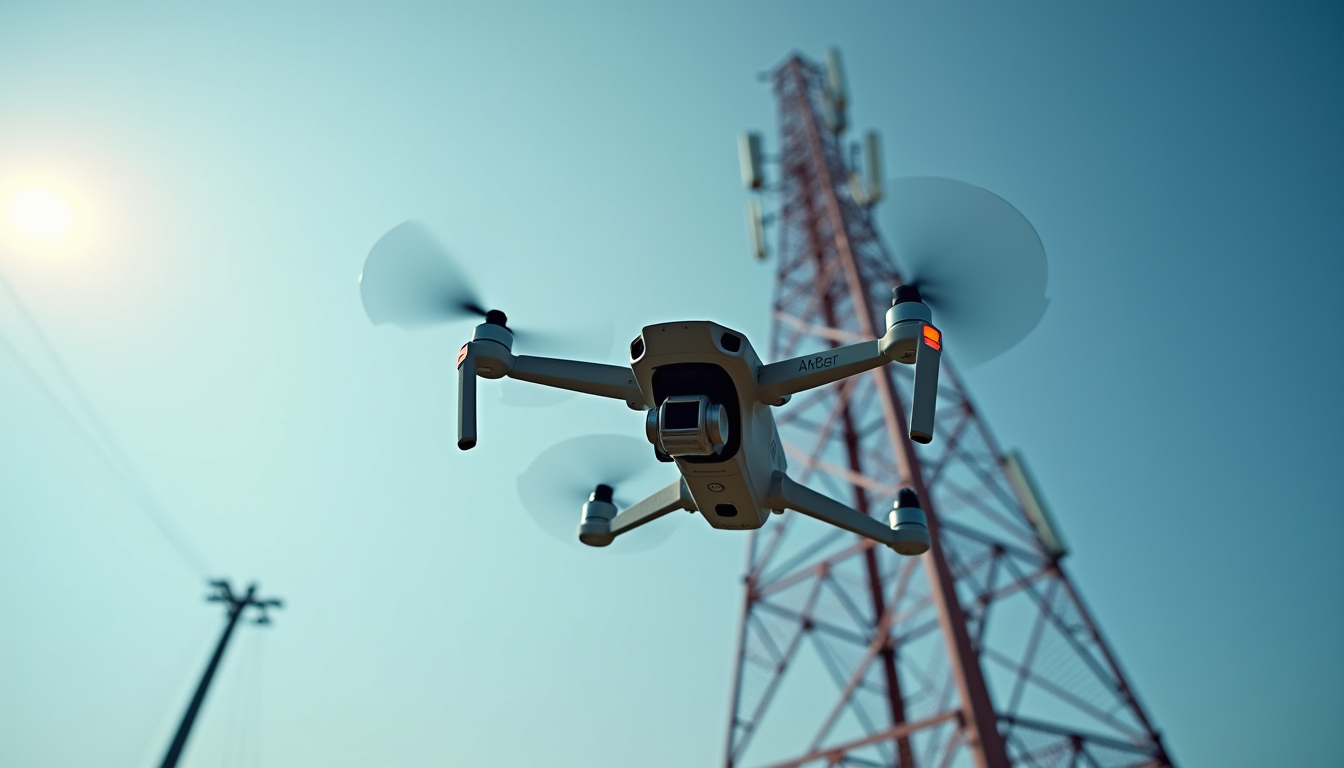
DRONE SURVEYS SPECIALISING IN TELECOMS
High-precision drone surveys for telecommunications networks — strengthened by over 30 years of expertise in Radio and Transmission Planning.
Protecting Mobile Site Performance from Environmental Change
Mobile network performance is not static. Even a perfectly designed site can experience gradual degradation over time due to changes in its surrounding environment.
Two of the most common causes are:
-
Tree growth – Seasonal foliage and long-term canopy expansion can obstruct signal paths, particularly on higher frequency bands such as 4G and 5G.
-
New construction – New buildings, extensions, cranes, and other structures can introduce unexpected shadowing, reflection, and diffraction effects.
Having worked for Vodafone, EE, BT, and Three UK, we recognise these local changes can compromise coverage, reduce data throughput, and impact customer experience.
Radio Planning and Optimisation considerations
Traditional radio planning assumes a stable environment. However, the reality is that:
-
Line-of-sight paths gradually become obstructed
-
Fresnel zones are encroached upon
-
Signal-to-interference ratios shift
-
Previously optimised tilts and azimuths become compromised
Without proactive monitoring, performance issues are often only discovered after customer complaints or KPI degradation.
WHAT WE DO
DRONE SURVEYS FOR
TELECOMS SITES: ROOFTOPS, MASTS, STREETWORKS
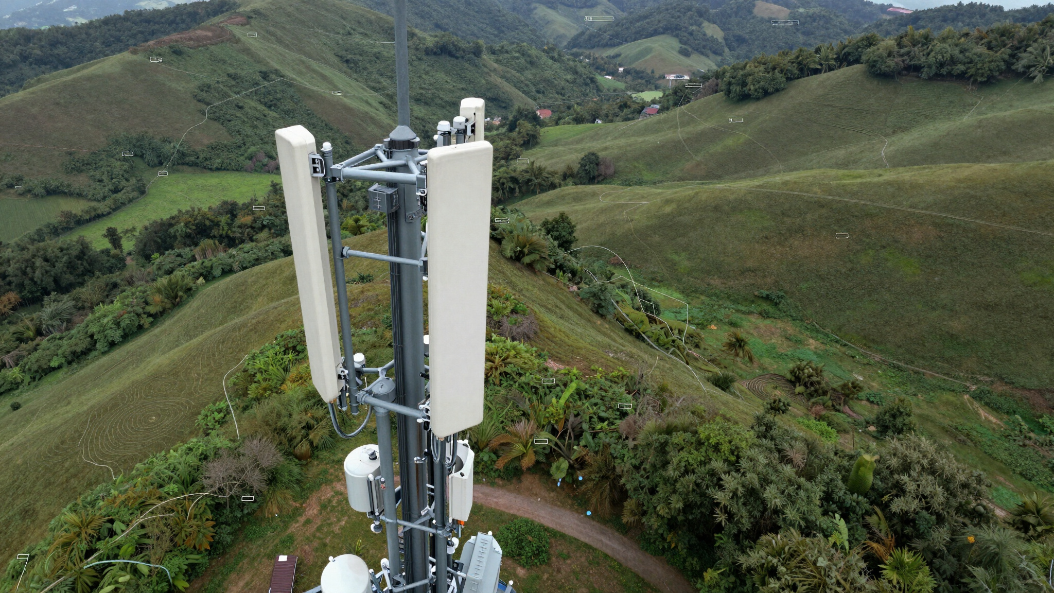
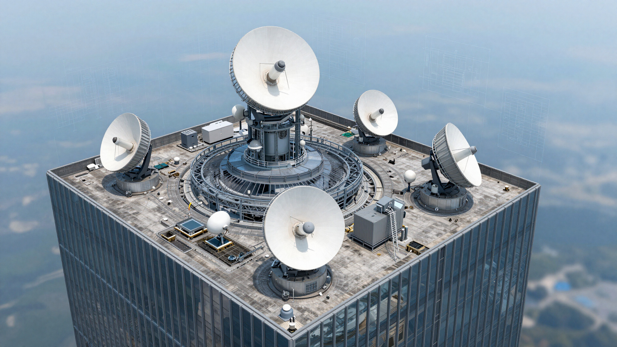
Detailed rooftop aerial, site layout imagery for telecoms planning and design teams, clearly showing equipment locations, feeder routes, access points, structural constraints, and spatial relationships to support accurate site design and upgrade planning.
EQUIPMENT AND ANTENNA POSITION VERIFICATION
We verify that mobile telecoms installations align precisely with design specifications, ensuring peak network reliability, coverage, and performance. Our drone inspections provide high-accuracy confirmation of antenna azimuth and boresight alignment.
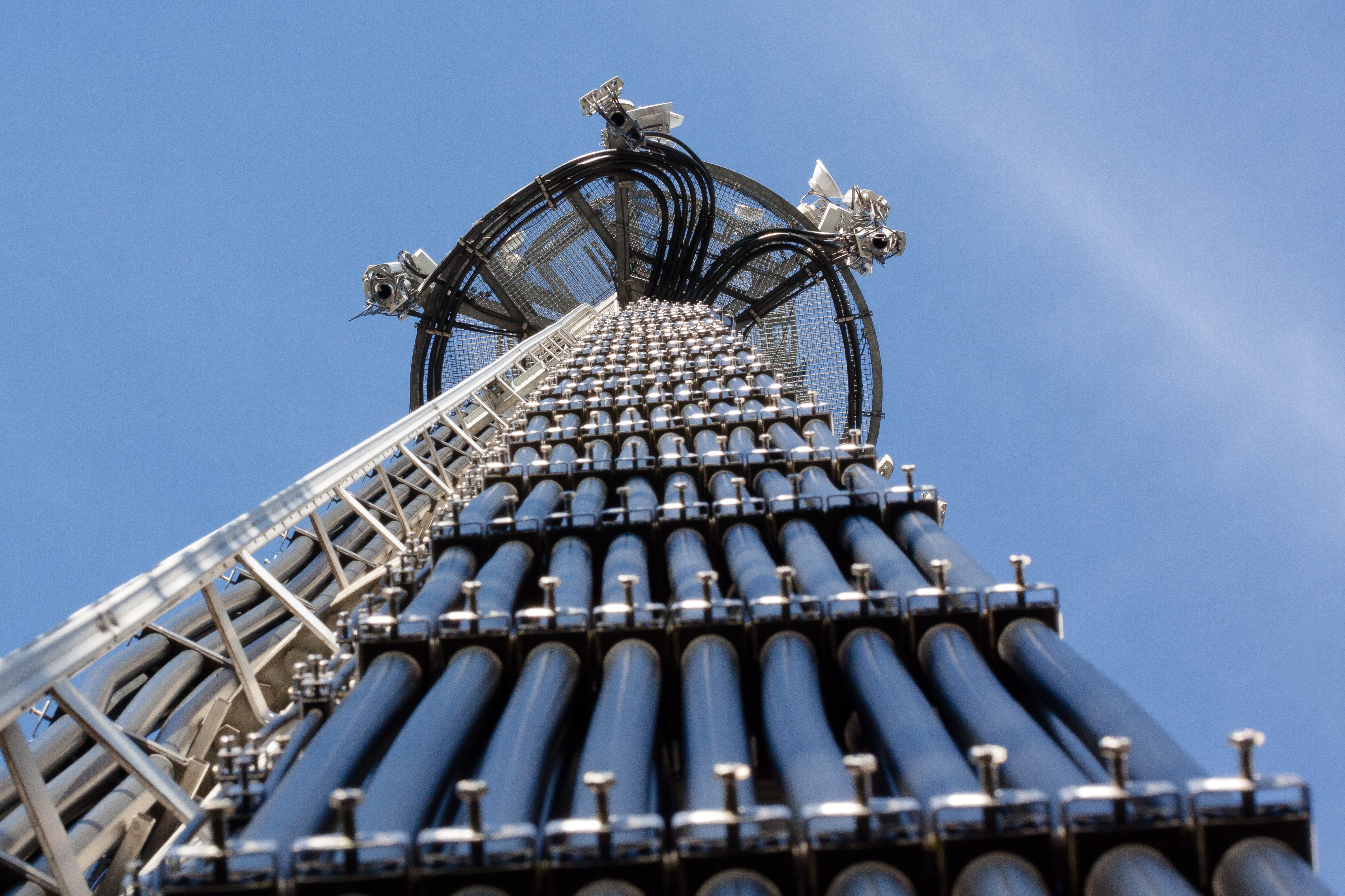
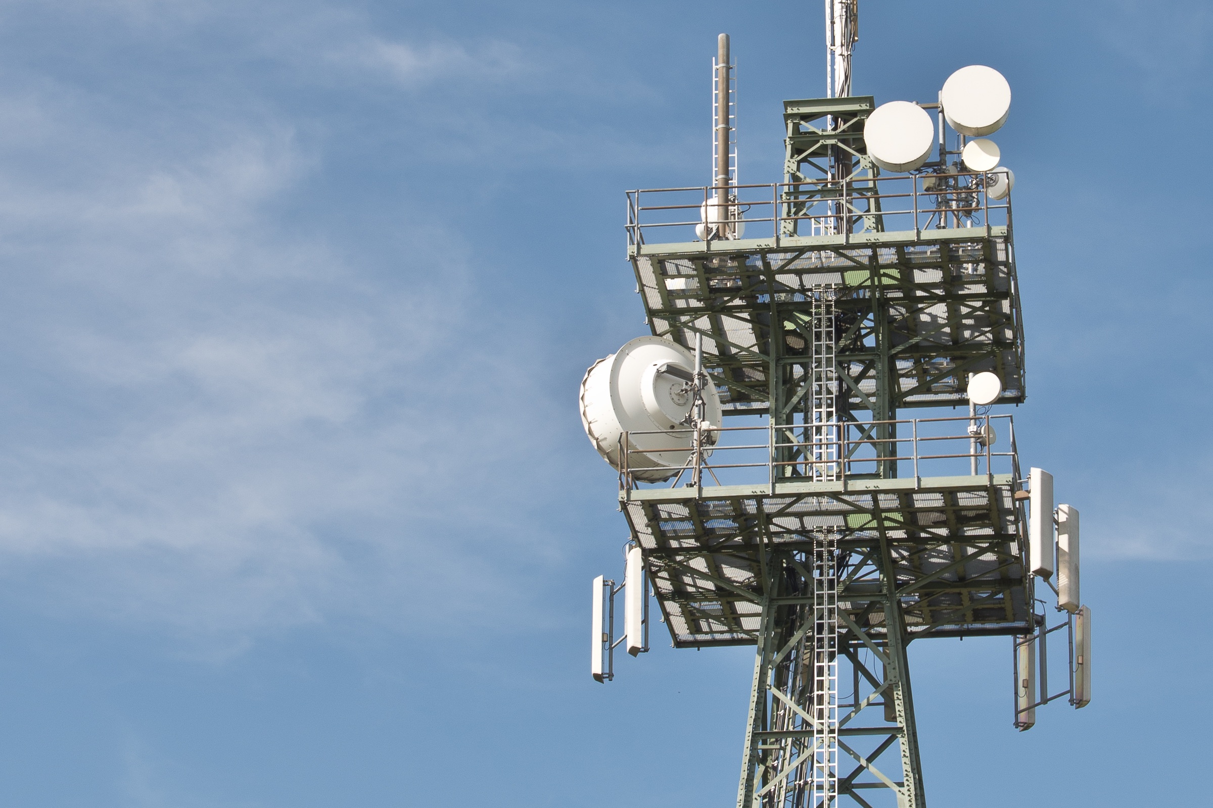
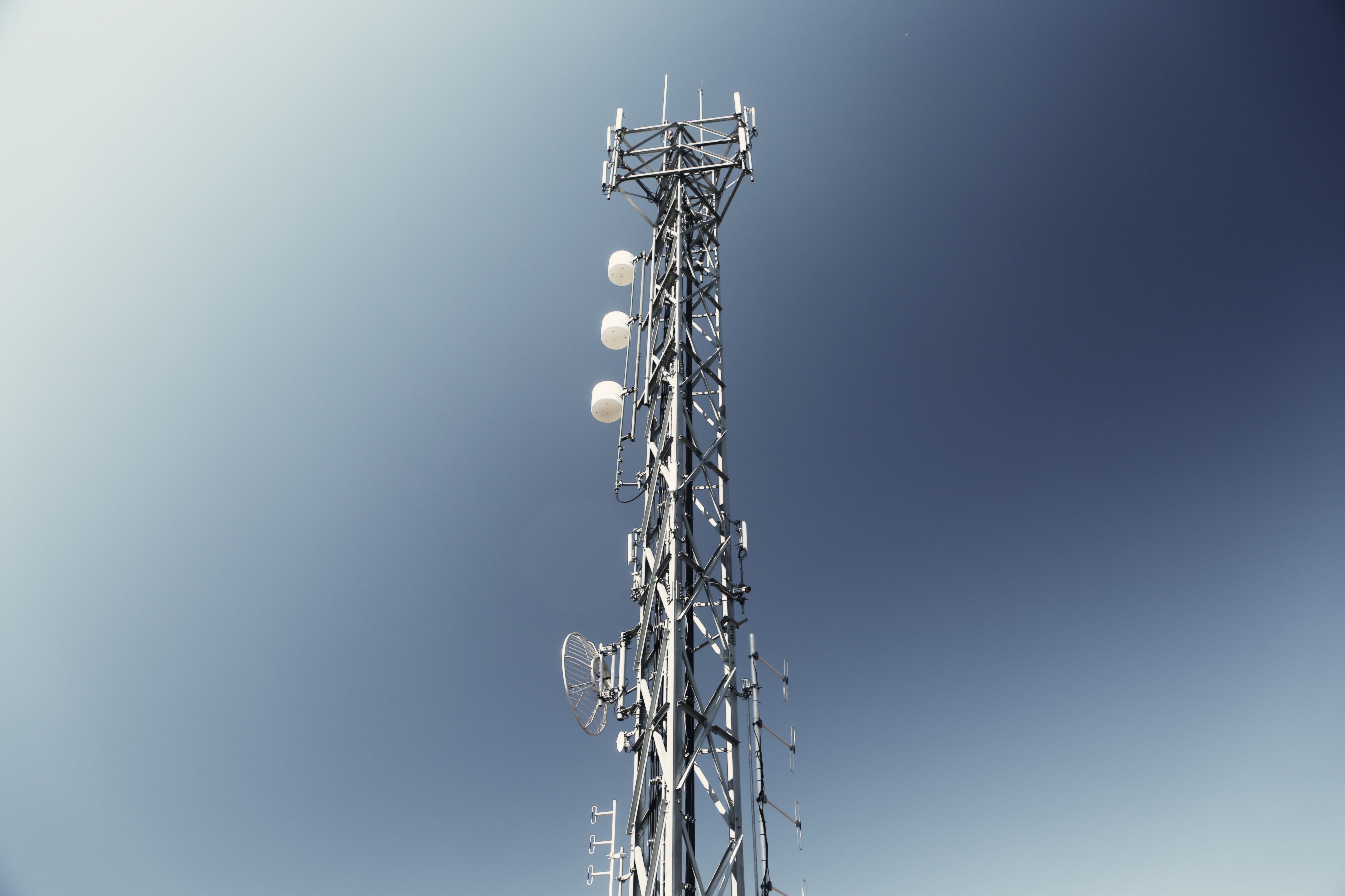
HIGH-RESOLUTION AERIAL PHOTOGRAPHY AND VIDEO - WITH LIVE STREAMING CAPABILITY
High-resolution aerial photography and video support mobile telecoms inspections, capturing detailed mast imagery, equipment condition, and site access constraints. Where accessible by the drone, antenna part numbers, connector types and feeder types, etc. can be captured.
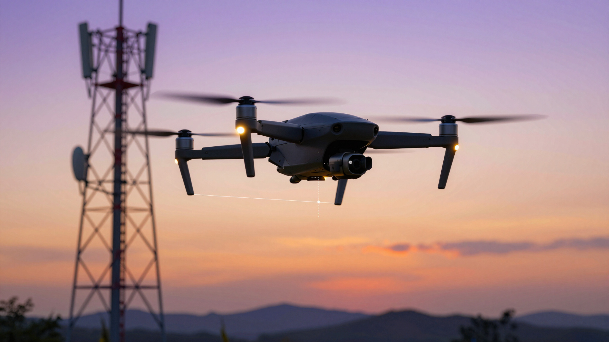
SAFER, SMARTER SITE SURVEYS
WHY DRONE SURVEYS?
Drone surveys for telecoms sites provide safe, accurate inspections, mapping infrastructure, assessing equipment, and reducing operational costs.
Drone inspections reduce climbing risks, traffic management needs, and the number of people required to attend mobile telecoms site surveys (MSVs) and maintenance activities.
WHO WE ARE
We are a team of Radio (RAN) Planning and Transmission Engineers
With experience in the deployment of 2G to 5G networks since the mid-1990s, we have expertise in Radio (RAN) and Transmission Planning, alongside hands-on installation and commissioning, supporting mobile network operators with proven technical knowledge and field expertise.
Because we understand telecoms infrastructure from both a design and deployment perspective, we go beyond simply capturing aerial imagery — working proactively to suggest practical solutions, and provide insights that support efficient network planning and delivery.
We have worked on projects with MNOs in the UK, across Europe, and the Middle East.
GALLERY


CONTACT US
enquiries@lstelecoms.com
CONTACT
+44 7775 593 593
PRECISION DRONE SURVEYING • TELECOMS INFRASTRUCTURE • VIRTUAL MSVs •